Mapping & Updating Deeds of Conditions
Key points
Whilst there are many types of developments and styles of deeds of conditions, there are some basic guidelines that should be followed:
1 Cadastral map or supplementary data?
- For a non-tenement property in a development (in other words, a house rather than a flat), the plans reference for the extent of the deed of conditions should be shown on the cadastral map. Whenever possible, the references should be shown on the primary ungrouped layer within Plan Creator, however with complex titles with multiple references, consideration can be given to placing the deed of conditions references in a Grouping containing an additional cadastral map view (layer).
- For a tenement property in a development (in other words, a flat rather than a house), where the deed of conditions affects an area larger than or co-extensive with the tenement steading cadastral unit, the plans reference for the extent of the deed of conditions should be shown on the cadastral map. Whenever possible, the references should be shown on the primary ungrouped layer within Plan Creator, however with complex titles with multiple references, consideration can be given to placing the deed of conditions references in a grouping containing an additional cadastral map view (layer). The references for the flat, etc will be shown on a separate grouping that contains the supplementary data for the flat.
- For a tenement property in a development (in other words, a flat rather than a house), where the deed of conditions affects an area smaller than the tenement steading cadastral unit, the plans reference for the extent of the deed of conditions should be shown on the grouping containing the supplementary data for the flat.
2 Reference to use
If a separate plans reference is being given for the extent of a deed of conditions, use a colour of edge other than red (use brown as the first preference) to avoid confusion with cadastral units. 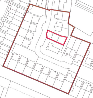
3 Classification
Whether the plans reference is shown on the primary ungrouped layer or within a grouping, the reference for the deed of conditions extent will still require to be classified in Plan Creator. Although the terms of the particular deed should be considered, the majority will be classified as Burden, or as Servitude and Burden.
4 Other plans references in a deed of conditions
If there are rights of ownership (exclusive or common) being created or defined in a deed of conditions, these should be mapped like any other right of ownership.
- For non-tenement property, either they will be set up as shared plots, or mapped as pertinents/mapped under the transitional provisions. In both styles, the plans references will be shown on the cadastral map (preferably on the primary ungrouped layer within Plan Creator, but in particularly complex titles with multiple references, consideration can be given to placing the deed of conditions references in a Grouping containing an additional cadastral map view (layer).
- For tenement properties, areas of exclusive ownership must be located within the extent of the tenement steading cadastral unit which is shown on the primary ungrouped layer, and the specific reference for the exclusive area will be shown on the grouping containing the supplementary data for the flat.
- For tenement properties, areas of common ownership that fall within the tenement steading cadastral unit/are owned jointly with those flat owners within the block will be shown on the grouping containing the supplementary data for the flat.
- For tenement properties, areas of common ownership that fall outwith the tenement steading cadastral unit/are owned jointly with those flat (and/or house) owners beyond the block will either be set up as shared plots or mapped as pertinents/mapped under the transitional provisions. If mapped as pertinents/mapped under the transitional provisions, the extent of the tenement steading cadastral unit on the primary ungrouped layer is extended to include the area of common ownership, and the specific reference for the common area will be shown on the grouping containing the supplementary data for the flat.
If there are other plans references being defined in a deed of conditions (for example, shared amenity areas in which no rights of common ownership are being created, service strips, etc.) a reference will be required for these.
- For non-tenement property, the plans references should be shown on the cadastral map (preferably on the primary ungrouped layer within Plan Creator, but in particularly complex titles with multiple references, consideration can be given to placing the deed of conditions references in a Grouping containing an additional cadastral map view (layer).
- For tenement property, where the reference(s) fall outwith the tenement steading cadastral unit, they should be shown on the cadastral map (preferably on the primary ungrouped layer within Plan Creator, but in particularly complex titles with multiple references, consideration can be given to placing the deed of conditions references in a Grouping containing an additional cadastral map view (layer).
- For tenement property, where the reference(s) fall within the tenement steading cadastral unit, they should be shown on the grouping containing the supplementary data for the flat.
What to do if the deed of conditions has been disapplied from an individual property or plot in a development?
- For a non-tenement property in a development, the plans reference(s) for the deed of conditions should be omitted from the mapping of the cadastral unit, and a Title Note added to the LRS bringing this to the attention of the legal settler.
- For a tenement property in a development, as all flats within the tenement must use the same mapping of the cadastral unit on the cadastral map, the plans reference(s) for the deed of conditions should be shown on the cadastral map in the normal way. A Title Note should be added to the LRS bringing this to the attention of the legal settler, and asking them to add a note to the end of the deed of conditions entry in the burdens section that the deed has been disapplied to the sitt.
Updating deed of conditions references or mapping style from 1979 Act to 2012 Act
When the Keeper has already established a set of mapping instructions for a deed of conditions (often in a research area (RA)) under the 1979 Act, these instructions will need to be re-considered in line with the 2012 Act when the first 2012 Act application within that development/RA is received for registration.
Under the 1979 Act, it was not always necessary for a deed plan to be included with a deed of conditions to identify the extent of any common areas (including amenity ground), service strips, burdened areas, etc. Under the 2012 Act, there can be no registration without mapping, and such areas must now be defined on an acceptable plan to allow them to be mapped onto the cadastral map. If the extent of such an area is not defined in a deed of conditions, the 2012 Act application for registration must be considered for rejection, unless the area is later defined in the extent deed or DIR for the property being registered. See Further Guidance page Common Areas - when to include, omit or reject for more details on how the policy is applied. The only exception to this will be a deed of conditions that is co-extensive with a tenement steading cadastral unit, as section 16 of the 2012 Act permits the use of verbal descriptions within a tenement steading.
Key points to consider when updating the deed of conditions mapping instructions
- The instructions will be held in (i) a parent title, either in the casenotes or in the files held within TP section; (ii) a research area (RA) (see separate instructions) whose instructions can be viewed and edited in the Universal Web Viewer, or occasionally (iii) a back-up file (BUF) index entry, but this will be referred to in the parent title notes or RA casenotes. It is possible to edit instructions in a BUF using the Plan Creator.
- The existing 1979 Act instructions should be retained (but clearly marked as for use with 1979 Act applications only). This could provide useful information to anyone considering the mapping of an existing registration, for example, Post Registration Enquiries.
- If the existing 1979 Act instructions are also applicable to any 2012 Act applications, with no changes required, then a note should be added to the instructions. This will inform future users that they have already been considered and are 2012 Act-compliant.
- If a new plans reference is required for the development/deed of conditions extent, use a colour of edge other than red to avoid confusion with cadastral units. See sections above on mapping styles.
- Particular consideration should be given to any common areas described in the deed of conditions. Any areas of common ownership must now be mapped onto the cadastral map - it is no longer allowable to either (a) verbalise a right of ownership of an area of ground, or (b) show a right of ownership on a scanned supplementary plan. The exception to this are rights of ownership (common and exclusive) within a tenement steading cadastral unit (see below). If there are rights of ownership conveyed to the common areas described in a deed of conditions, these common areas must be capable of being mapped onto the cadastral map otherwise the un-mappable common areas policy should be applied (the extent of the common area(s) can be shown in the deed of conditions itself, or could be annexed to the extent deed or DIR for the property being registered).
- In developments that were started under the 1979 Act and registration of properties is now continuing under the 2012 Act, it is sometimes allowable to continue to use existing scanned supplementary plans provided all ownership references are transferred onto the cadastral map. See the Further Guidance pages on Assigning or Retaining Scanned Supplementary plans for the process steps to follow and a useful checklist to help with the decision making. It is also sometimes allowable to continue to use supplementary data that were formerly shown on plotted SPLs - instead, these plans references would now be set up on one or more groupings associated with the title.
- If there are mapping instructions relating to tenement properties within the deed of condtions or co-extensive with the deed of conditions, the mapping style will need to be considered. Under the 1979 Act, there were a variety of styles used for tenement properties but under the 2012 Act, a tenement steading cadastral unit is required for each tenement block - see Mapping Tenements for more details. Section 16 of the Act allows verbal descriptions within a tenement steading cadastral unit, so if the deed of conditions is co-extensive with the tenement steading, common areas referred to in a deed of conditions may be verbalised. If plans references are required for any pertinents of a flat within a tenement steading, the Keeper's practice is to now use a grouping to show these as supplementary data for the flat.
- Full details of all changes being made to references must be provided to legal as the editing of the deed of conditions and other common burdens deeds will need to be amended to take into account the new mapping instructions.
Updating an RA with a deed of conditions for 2012 Act compliance
When the Keeper has already established a set of mapping instructions for a deed of conditions in a research area (RA) under the 1979 Act, these instructions will need to be re-considered in line with the 2012 Act when the first 2012 Act application within that development/RA is received for registration. Similar guidance for referral officers on updating RAs has been provided on Research Areas for Plans Settlers.
Updating deed of conditions references or mapping style from DMS to the Plan Creator
In addition to the updates required by the change in legislation, the change in mapping technology developed and used by RoS has also introduced some necessary updates.
Key points to consider when updating the RA mapping instructions for use in Plan Creator
- Probably the main change that may affect an existing deed of conditions, depending on the style of title within the development, is the introduction of the groupings functionality within the Plan Creator. References formerly shown on plotted SPL index entries that were then assigned to each title are now mapped directly within the title on the Plan Creator using a grouping or layer. So the instructions may need to be changed from "assign spl MIDxxx-1 to all titles" to "copy style of MIDxxx and show deed of conditions references as a separate grouping (additional cadastral map view 1)".
- The use of multiple edges is not readily supported within the Plan Creator so it may be necessary to reconsider the edges, tints and hatches used for titles within the development - the guidance page Mapping Styles and Plans References for more details.
- If any mapping updates are required to the way a deed of conditions is shown within a parent title, all the plans references in the parent title will need to be classified.
- If there is an instruction to bring forward a letter reference from the deed of conditions/parent title onto all or some titles, the instructions should be updated to say that the letter reference will need to be remapped as a label using the Classification function within Plan Creator.
- The Duplicate title function within Plan Creator adds the references from the duplicated title into your DCU rather than over-writing them. Therefore, it may be useful in some circumstances to instruct the use of this functionality in updated parent title instructions to make sure all common references are used in a consistent way. Just remember that if you instruct other settlers to duplicate DMFxxx to get all the common deed of conditions references into their DCU, you will also have to instruct them to delete particular references that relate only to the duplicated title (for example, the other house plot).
- Full details of all changes being made to references must be provided to legal as the editing of the deed of conditions and other related burdens deeds may need to be amended to take into account the new mapping instructions.
Registers of Scotland (RoS) seeks to ensure that the information published in the 2012 Act Registration Manual is up to date and accurate but it may be amended from time to time.
The Manual is an internal document intended for RoS staff only. The information in the Manual does not constitute legal or professional advice and RoS cannot accept any liability for actions arising from its use.
Using this website requires you to accept cookies. More information on cookies.
Feedback