This is the registration manual for 1979 casework.
Do not under any circumstances use the information here when settling 2012 casework. This resource has been archived and is no longer being updated. As such, it contains many broken links. Much of the information contained here is obsolete or superseded.
P22.9 - Section 9 - Conflicts in Extent with the Ordnance Survey Map
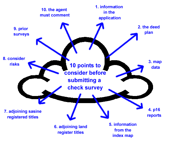
Ten Point Checklist - What to consider before sending a Check Survey
In the most straight forward example where the deed plan information disagrees with the detail on the Ordnance Map, consideration needs to be given to whether the deed plan, or the Ordnance Map, is wrong. You should ensure that the following 10 Points have been considered before instigating a survey:
Please click on each of the 10 points below for more information....
1. Information in the Application
1.1 Does the application include any further information relating to the problem (e.g. Notes on Form 1, letters, additional plans and or photographs)?
1.2 Has the Agent confirmed that the legal extent depicted in the deeds submitted agrees with the occupied extent as viewed?
1.3 Is there any note of adverse possession?
1.4 Are there any further deeds referred to that either add to, or remove from the land, that results in agreement between the deeds and the Ordnance Map?
1.5 Is there any corrective conveyancing either with the application, attached applications or pending applications?
2. The Deed for Extent
2.1 Is the extent of the subjects based on a new plan annexed to the Deed Inducing Registration or a Certified Plan? (And if so, can Prescriptive Title be proven?)
2.2 Is the area in question excepted from warrandice?
2.3 Are there any errors made in the quoted dimensions in the text or the plan to the deed for extent?
2.4 Is the deed plan a dimensioned sketch?
This problem results from the use of an Architects plan which shows the proposed layout. Instead of producing a further survey which shows the position as built on the ground, the vendor's solicitor arranges for a site visit on each sale, runs a tape measure round the main features and shows the dimensions of those features on the Architects plan. No attempt is made to make the deed plan reflect the picture on the ground and it is therefore impossible to scale from such plans. In many instances, if the dimensions shown on this type of plan conform with the Ordnance Map, mapping can proceed.
Identification of these types of plans requires experience, if in doubt, refer to your Plans Referral Point.
2.5 Is the deed plan or description defective (e.g. Floating Shape)?
The quality of the deed plan may be so poor as to make it unacceptable for registration purposes. The Land Registration (Scotland) Act 1979 makes it clear that a description or plan relating to land must be capable of identification on the Ordnance Map. Do not waste time trying to make a plan or description fit, when it is clear that it is inadequate.
Any plan referred to must meet the Keepers published Deed Plan Criteria.
2.6 Is the deed plan qualified by the remark "demonstrative only and not taxative"?
Clearly if there are material differences between the deed and Ordnance Map, the above quote is no more than a disclaimer as regards the accuracy of the deed plan. Further information and/or:-
• a replacement plan if dealing with the DIR as the breakaway in the application, or
• a certified plan if dealing with a recorded deed as the breakaway in the application,
should be sought from the Agent before any further time is spent or expense incurred as, in the event of an accurate plan being forthcoming, all apparent discrepancies may not, finally, exist.
Note: bear in mind that we start from a position of exclusion of indemnity when we receive a certified plan.
3. Map Data
3.1 Can the problem be accounted for by the tolerances and criteria of the Ordnance Survey Map?
3.2 Is there any evidence to be gleaned from the Ordnance Map that suggests severe slopes exist that may account for differences in the lengths of boundaries? (Look for spot heights, or symbols representing sloping banks or steps shown on the Ordnance Map.)
3.3 How are the subjects depicted on the County Series?
3.4 How are the subjects depicted on prior versions of the Ordnance Map?
3.5 How are the subjects depicted on the aerial photography layer of the Spatial Data Browser?
3.6 How are the subjects depicted on MasterMap and does the Topographic Identifier (TOID) include any details on the age and nature of features and/or the date surveyed?
3.7 Have the subjects (or the area surrounding the subjects) been updated as part of the Positional Accuracy Initiative?
3.8 Is the current map held by the Keeper up to date? Check for latest detail on the Ordnance Survey website.
3.9 Are there any pending updates on the DMS which have yet to be released?
4. P16 Reports
4.1 Has a P16 Report, with an Answer 3, been issued in respect of these subjects?
And if so, has any action been taken by either the selling or purchasing agent in response to it?
Note: if the Agent has not taken any action, refer to RO1 to discuss how to contact Agent. The Agent must have commented directly on the nature of the discrepancy, either by answering the questions on the Form 1 or by documenting his findings and intentions in writing, before a Survey can be requisitioned.
4.2 Has, in your opinion, a P16 Answer 2 been issued in error?
Note: if Yes refer to RO1 to discuss how to contact Agent. This should be done in writing basing letter on questions in Form 1 in order that the relevant information can be provided to make a decision on the application.
5. Information from the Index Map
5.1 Does the area in question fall within or outwith the Research Area / Builders Title?
If affecting does the R/A include mapping instructions?
5.2 Are the subjects covered by Development on the Ground procedures?
5.3 Are there any notes or procedures already established and annotated on the Index Map e.g. Pre Registration Correspondence and / or Back Up Files?
6. Adjoining Land Register Titles
6.1 Are the adjoining subjects registered or pending registration in the Land Register?
6.2 Does the extent of the adjoining registration and / or pending registration agree with the deed plan or Ordnance Map depiction of the subjects in this title? (Provide copy deeds / plans as appropriate from Fiche, Archive and Scottish Record Office.)
6.3 Does the extent of the adjoining registration and / or pending registration overlap with the extent of the subjects in this title as depicted in the deed plan or on the Ordnance Map? (Provide original Title Plans for back converted titles.)
6.4 Have, in your opinion, the adjoining registered subjects been mapped correctly? (Provide copy deeds / plans as appropriate and original Title Plans for back converted titles.)
7. Adjoining Sasine Recorded Titles
7.1 Does the extent of the adjoining Sasine Recorded subjects agree with the deed plan or Ordnance Map depiction of the subjects in this title? (Provide copy deeds / plans as appropriate from the Scottish Record Office.)
7.2 Does the extent of the adjoining Sasine Recorded subjects overlap with the extent of the subjects in this title as depicted in the deep plan or on the Ordnance Map? (Provide copy deeds / plans as appropriate from the Scottish Record Office.)
8. Consider Risks
8.1 Adjoining deeds may negate a problem e.g. if the extent of the subjects in this title falls short of a particular boundary, but the adjoining title abuts the boundary, it may be a reasonable risk to accept as defined, depending on the area of ground involved, but see below.
8.2 If the legal extent falls short of a physical boundary, particularly if it should form a narrow parallel strip, the situation could be correct. The strip may form an access to other property, or a maintenance strip belonging to adjoining property.
9. Prior Surveys
9.1 Check for prior Surveys in the development / estate – what were the results:-
(a) no change - agent should be contacted to clarify position or D.O.G. should be considered (another individual survey is not an option at this stage).
(b) changed to agree with deed plan - it would then be a justifiable risk that the deed plan reflects what is on the ground, therefore the options to be considered are either to plot legal extent or contact the Map Base Maintenance Manager to consider if OS should be contacted to re-survey the whole development.
(c) changed to disagree with deed plan – agent should be contacted to clarify position, an additional survey may be considered, contact the Map Base Maintenance Manager to consider if Ordnance Survey should be contacted to re-survey the whole development.
10. The Agent
10.1 The Agent must have commented directly on the nature of the discrepancy, either by answering the questions on the Form 1 or by documenting his findings and intentions in writing, before a Survey can be requisitioned. If they have not done so then the Agent must be contacted for their comments before considering a survey.
After you have carried out all the before mentioned examinations and the conclusion is that a survey is required you then have to examine the survey options, i.e. OS or ROS
By asking a few simply questions you should reach the correct conclusion
(1) Is the survey 1/1250?
YES — go to (2)
NO — go to (3)
(2) Is there sufficient detail within 30m (100’) for the ROS surveyor to use as control points?
YES — SEND ROS SURVEYOR
NO — SEND OS SURVEYOR
(3) Is the survey 1/2500 and for inspection purposes only and the detail is likely to remain the same?
YES — SEND ROS SURVEYOR
NO — SEND OS SURVEYOR
Now that we have decided on which survey to send we have to consider what questions to ask and how to ask them.
When you have completed a survey requisition form it is important to complete a review before submission. Ask yourself:
-Do my questions make sense?
-Do they really ask for the information I want (if in doubt ask some one else to read it)
-If the detail doesn’t change to agree with the deed, have I ask all the pertinent questions required to find out all the relevant facts in case I have to send the case to EBM or refer back to the agent?
*
This is the registration manual for 1979 casework.
Do not under any circumstances use the information here when settling 2012 casework. This resource has been archived and is no longer being updated. As such, it contains many broken links. Much of the information contained here is obsolete or superseded.
*
The Manual is an internal document intended for RoS staff only. The information in the Manual does not constitute legal or professional advice and RoS cannot accept any liability for actions arising from its use.
Using this website requires you to accept cookies. More information on cookies.