PV 24 - How do I measure an area?
- Editor9
- RPT Admin (Unlicensed)
To take an area measurement in the Plan Viewer (PV), start by selecting the measure area tool on the left hand side of the PV window.
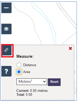
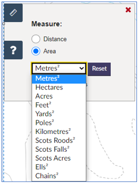
The tool measures the total size of an area shown on the map. You can change the measuring units by clicking on the drop down menu.
Measuring in square feet will show in square feet and square inches in the measurement box.
The measurement toolbox displays two measurements -
- the current measurement shows the distance from the last point you have clicked - this is a "live" measurement and will change as you move your cursor around the screen; and
- the total measurement shows the total area of the polygon you have measured.
Please note, given the complexity around converting every area unit into its corresponding distance unit, the Current measurement is always shown in metres for consistency, and no further enhancements will be made to this – this tool is intended to measure area, and if segments need to be measured, this can be done by using the Distance Tool.
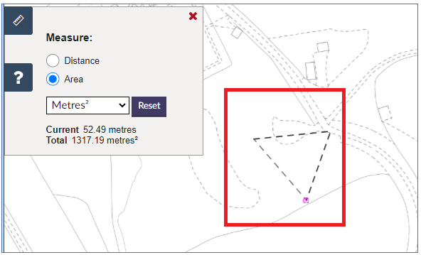
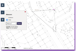
To use the measure area tool, select the tool and click on the first point you want to measure from. Then move your cursor and click on the second, third, etc. points making the polygon you want to measure. The total area between these points will display in the measurement toolbox. In this example, this distance between the last two points selected on the map measure 52.49m and the total area of the polygon drawn on the map measures 1317.19 square metres. |
|
To continue to build the polygon you wish to measure, click on additional points until you have completed measuring. When you have finished, click the right mouse button to finish. The line section and the total area measurement will remain on the map until you start a new measurement, deselect the measure tool, or select a different tool. In this example, the total area of the polygon drawn on the map measures 3370.03 square metres. | 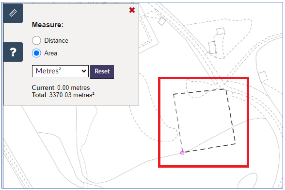 |
- If the area measurement in a deed is narrated in a unit that is not in the drop down list, various measurement converters exist on the internet to convert between measurement units.
- All mapped polygons on the Index, Title, or Draft Plan layers have an area measurement in hectares displayed next to the polygon on the feature list when that Index, Title, or Draft Plan is viewed.
Known issue - invalid geometry
Please note there is a known issue with the measure area tool - currently invalid geometry can be created with a self-intersecting polygon.
|
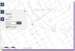
As soon as a self-intersecting polygon is created the total area is compromised and therefore cannot be trusted. Please ensure no self-intersecting polygons are created.
Registers of Scotland (RoS) seeks to ensure that the information published in the 2012 Act Registration Manual is up to date and accurate but it may be amended from time to time.
The Manual is an internal document intended for RoS staff only. The information in the Manual does not constitute legal or professional advice and RoS cannot accept any liability for actions arising from its use.
Using this website requires you to accept cookies. More information on cookies.
Feedback