11.0 Importing from QGIS into Plan Creator
- Editor9
Analytics
This guidance is for those applications where QGIS has been used to create the extent of the subjects by geo-referencing the deed plan.
| 1 The extent of the geo-referenced subjects in QGIS will be on a layer. Ensure that the layer is saved. | |
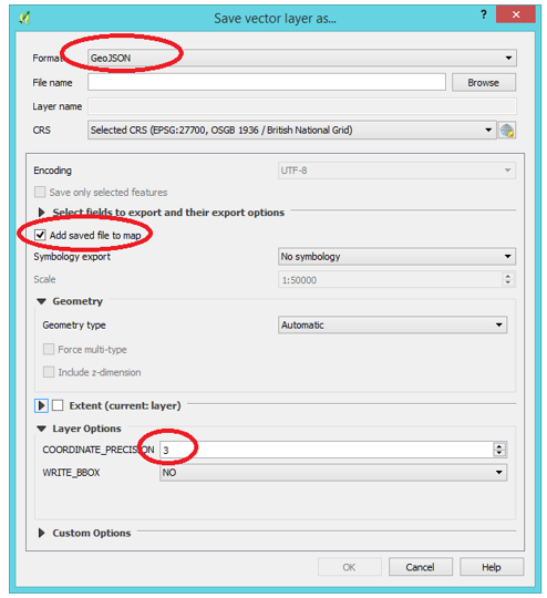
| 2 Ensure that layer is selected and highlighted, right click the mouse on the layer and select Save As.... | |
3 This pop up window will appear.
|
|
| 4 The saved GeoJSON file will now be displayed as a layer in QGIS. | |
5 In order to ensure that the file will import to Plan Creator, run a geometry check. Select the toolbar if this is visible, or from the dropdown menus select
| 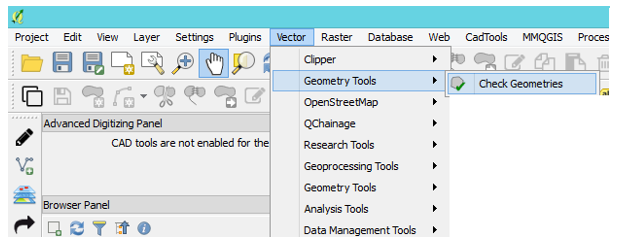 |
6 This pop out window will appear. Select the GeoJSON file as the Input Vector Layer. The recommended settings are as in this illustration. Ensure Modify Input Layer is selected, and click on Run. | 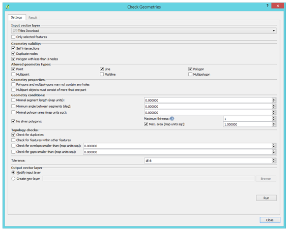 |
7 If any geometry errors are found, the result will be in the results window. For example, in this window three duplicate nodes have been found. | 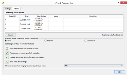 |
8 By selecting the entries in the result you can see the errors highlighted on the map. To fix the errors click on Fix selected errors using default resolution. The fixed GeoJSON file should now be able to be placed into the Plan Creator. | 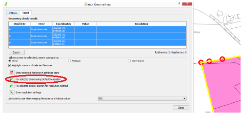 |
| 9 Create a DCU in the normal way in the Plan Creator. | |
| 10 In Windows File Explorer from the Windows desktop taskbar, navigate to the location where the GeoJSON file has been saved. | |
11 Click on the GeoJSON file and while holding down the left mouse button, drag the file over the Plan Creator map. The extent plotted in QGIS will now appear. | 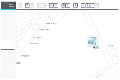 |
| 12 Style and classify the polygon appropriately, and complete the plans settle of the case as normal. | |
| 13 If the QGIS project and GeoJSON file are not to be retained for future use, these can now be deleted. | |
Notes:
- For users who have a template in QGIS, style and classify the polygon in the attribute table before creating the GeoJSON file. This will ensure that when the file is dropped into Plan Creator the style and classification is already done. See QGIS mapping instructions for how to do this.
- If the GeoJSON file does not drop into Plan Creator, there will be probably still be a geometry error. See QGIS mapping instructions for guidance on running further geometry checks.
Registers of Scotland (RoS) seeks to ensure that the information published in the 2012 Act Registration Manual is up to date and accurate but it may be amended from time to time.
The Manual is an internal document intended for RoS staff only. The information in the Manual does not constitute legal or professional advice and RoS cannot accept any liability for actions arising from its use.
Using this website requires you to accept cookies. More information on cookies.
Feedback